
How we do it
1
Data Collection
2
Point Cloud Manipulation
3
3D Modeling
4
2D Drawings
5
Asset Management
6
Animation & Fly-Through
At SOKCON Services we acquire and use the latest in surveying technology. High Definition Laser Scanner, Robotic Total Stations, GPS and High Precision Digital Levels are some of the technology used by our professional team to ensure the completion of your project as per your requirements, on time and without exceeding your budget.
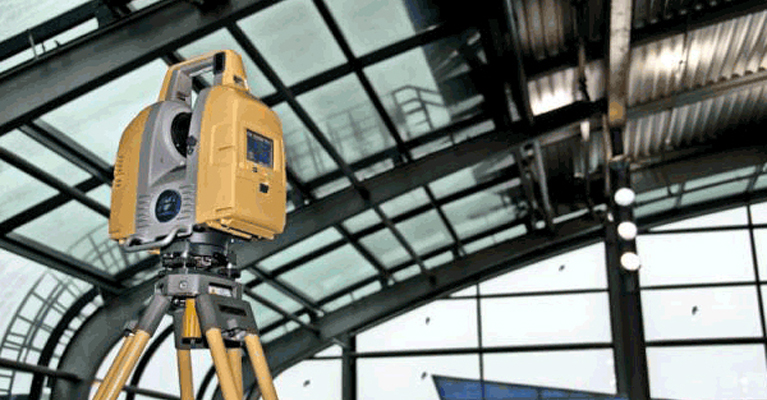
Terrestrial Scanning
- Building Information Models (BIM)
- Quality Control & Verification
- Historical Archiving and Preservation
- Forensic and Crime Analysis
- Commercial and Safety Planning
- Industrial Planning
- 3D As-Built Surveys
- Renovation and Remodeling
- Castles and Palaces Documentation

Mobile Mapping
- Mobile Mapping
- Urban Planning
- Infrastructure Inspection
- Geographical Modeling
- Commercial and Safety Planning
- Telecommunications
- Pipelines & Railways
- Disaster Management, Risk Management Mapping
- Airports & Runways (Deformations and cracks)
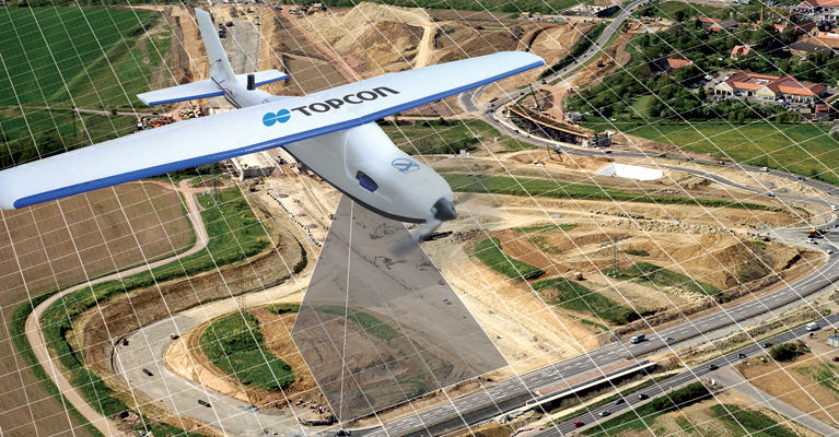
Unmanned Aerial Mapping
- Stockpiling and Volume Calculations (Mining)
- Urban Planning
- Geographical Modeling
- Telecommunications
- Pipelines
- Railways
- Disaster Management
- Promotional Applications
- Mining and Quarrying
Benefits
- Fast, reliable, and accurate data acquisition
- Survey building features with incredible detail
- Compare "as-designed" model to "as-built" constructions
- Quickly capture all the physical measurements with least disruption for property owners, businesses and tenants
- Save time in design work for reverse engineering
- Quality control and safety improvement